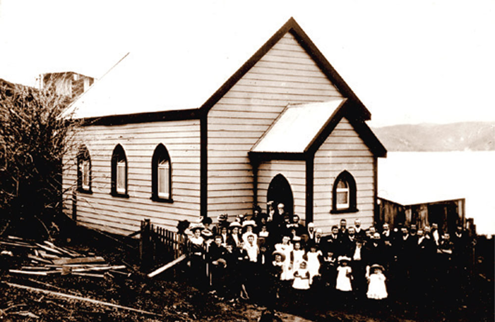
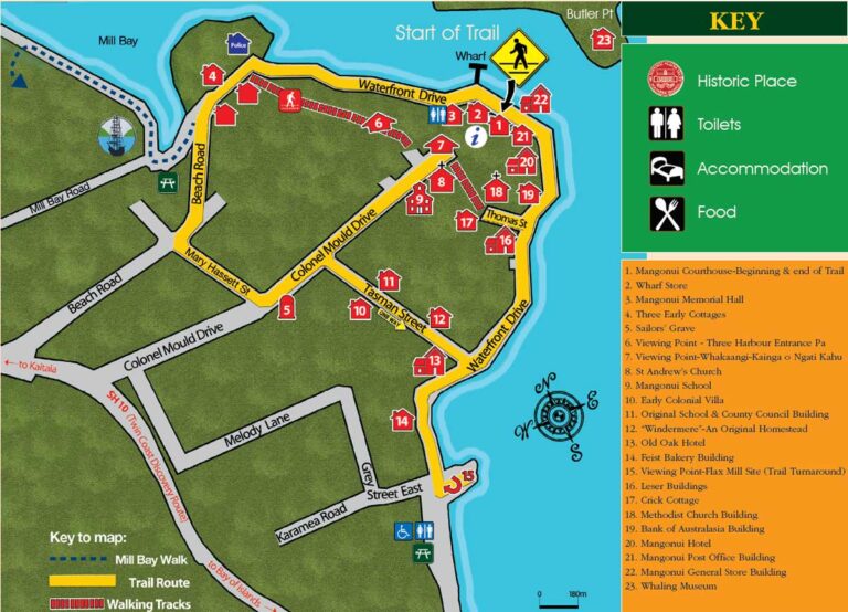
Sites are indicated by Heritage Trail markers. Some of these provide information at the site itself. All have a site number and a QR code which can be scanned to provide further information.
The Trail is three kilometres in length and accessible by foot or vehicle. The average time it takes to walk the Trail is one-and-a-half hours. Walkers are advised to take the St Andrew’s walkway to access sites and enjoy the spectacular views from above Mangonui. Please be aware that Mary Hassett Street (formerly known as Grey Street West) and Tasman Street are very steep.
The development of the Mangonui Heritage Trail would not have been possible without the inspiration of Neva Clarke McKenna. Much of the historical information offered on this trail is derived from her book "Mangonui - Gateway to the Far North" published by the Northland Historical Publications Society Inc. in 1990. The Trail itself is based on Ms. Clarke McKenna's Historical Mangonui Walk outlined in her books, "Doubtless Bay" and "Discovering Northland’s Past".
The Polynesian navigator Kupe visited this area about 900 AD in the canoe Mamaru. On a return trip, the Mamaru brought the chiefs Te Parata and Tumoana; ancestors of the Ngati Kahu. Later, another canoe, the Ruakaramea, was guided into a harbour by a shark. Its chief, Moehuri, named the harbour Mangonui, which means 'large shark'.
Mangonui was known as a safe harbour for whaling vessels by the late 1700s and, in 1831, the first European settler arrived.
By the mid 1800s Mangonui was a centre for whalers and traders; the saw milling, flax and gum industries were flourishing. In the 1900s these industries declined; roads replacing the sea as the main transport route and Mangonui became a much quieter place.
The Methodist Church was built in 1909 on this site, but was unable to be preserved. It was demolished for safety reasons in 2009 after 100 years.
Next:
Continue down Thomas Street and turn left back on to Waterfront Road to the site of Bank of Australasia Building. Site 19 on the left.